


RELATED PRODUCTS


Afternoon Realistic Lake Map
Introducing our Afternoon Realistic Lake Map – a captivating and immersive depiction of a tranquil lakeside scene, bathed in the warm and inviting hues of a late afternoon sun. Whether you're an artist, photographer, nature lover, or designer, this map brings the serene beauty of a lakeside afternoon right to your fingertips.


Estonia Deployment Map Bundle
The Estonian Republic consists of the mainland, the larger islands of Saaremaa and Hiiumaa, and over 2,200 other islands and islets on the eastern coast of the Baltic Sea, covering a total area of 45,339 square kilometres. The capital city Tallinn and Tartu are the two largest urban areas of the country. These maps are largely based off "Operation Cabrit" which is the name of the UK operational deployment to Estonia where British troops are leading a multinational battlegroup as part of the enhanced forward resistance to Russia.


Generic English Seaside Town
The Generic English Seaside Town map in Roblox offers a charming and immersive setting for coastal roleplay. Featuring a large town layout with open spaces, it captures the essence of a traditional British seaside community that thrives by the sea. Perfect for civilian, emergency services, or coastal military roleplay, this map gives you a strong foundation to grow and customise your vibrant community.


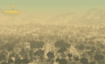
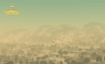
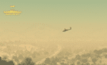
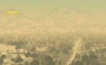
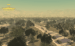
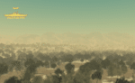
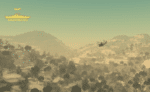
Sudan Terrain Map
Sudan is a war torn country in North East Africa, this piece of detailed and quality terrain is based around South Kordofan State which is located on the border of South Sudan. This area is known to hold many pro South Sudanese communities as well as many within the mountains who fought during the long Civil War. This is just the individual terrain, a full map will be released in the future.


Weihaiwei, North East China Map
Weihaiwei or Wei-hia-wei, on the north-eastern coast of China, was a leased territory of the United Kingdom from 1898 until 1930. The capital was Port Edward, which lay in what is now the centre of Huancui District in the city of Weihai in the province of Shandong. The leased territory covered 288 square miles and included the walled city of Weihaiwei, Port Edward just to the north. Includes custom lighting to match the area.
Reviews
Clear filtersThere are no reviews yet.